Someone made a map of every pub in the UK - and this is what South Yorkshire looks like
They say Britain is a nation of boozers - and this map certainly seems to prove it.


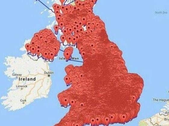
Someone has created a map plotting what they say is every single pub in the country - and its a sea of red.
And we've checked out to see what South Yorkshire looks like - and Sheffield, Doncaster, Rotherham and Barnsley are all buried under a plethora of little red pin points.
Advertisement
Hide AdAdvertisement
Hide AdFigures from 2013 show there were 48,000 pubs in the country, though the number has now decreased.
Camra predicts 27 pubs close every week, but even the most remote corners of the kingdom still have them.